Catalog Archive
Auction 199, Lot 128

"Carte des Provinces Septles. des Etats-Unis", Rochefoucald Liancourt, Francois Alexander

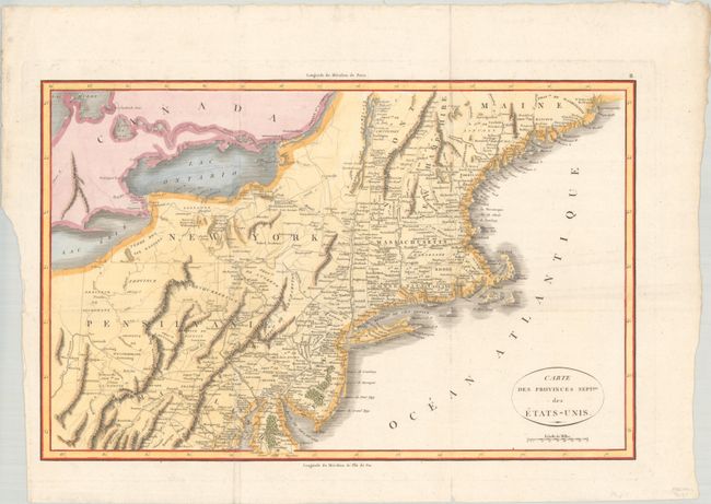
Subject: Eastern United States

Period: 1807 (circa)

Publication:

Color: Hand Color

Size:
19.9 x 12.7 inches
50.5 x 32.3 cm
Download High Resolution Image
(or just click on image to launch the Zoom viewer)

An uncommon and crisply engraved map describing the northern part of the young United States. The map extends from the Passamaquoddy Bay in Maine down to Delaware and west to Lake Erie. It provides a nice view of early settlements and roads, as well as the mountains and forests.

References:

Condition: A

A crisp impression on a bright sheet with a "T [heart] V" watermark, issued folded and now flattened. There is marginal soiling along the deckled edges.

Estimate: $200 - $230

Sold for: $150

Closed on 9/11/2024

Archived