Subject: Eastern United States
Period: 1855 (published)
Publication:
Color: Hand Color
Size:
28.4 x 21.6 inches
72.1 x 54.9 cm
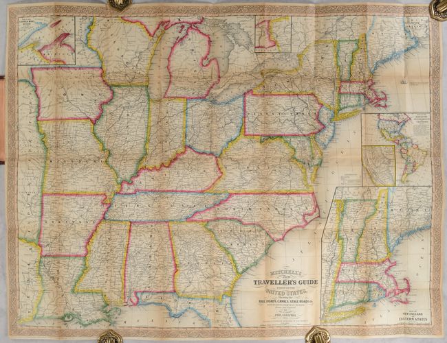
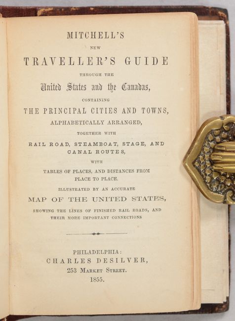
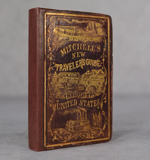
This pocket map shows the United States west to the Mississippi River and a little beyond to include a small portion of Texas and Indian Territory. The map is very detailed and features five insets, several of which promote the California Gold Rush: New England; a map of the western hemisphere showing "Maritime and Overland Routes to California"; a map of the Gold region in California; the copper mines region surrounding Lake Superior; and the vicinity of Niagara Falls. The labyrinth of canals and early roads are clearly shown. The legend shows a bold line for railroads, with proposed railroads and those in progress also marked. This series of maps, first published in 1832, was designed for the market represented by the burgeoning number of travelers and new immigrants. The maps were printed on thin bank note paper and folded so they could be carried easily for quick reference while traveling. Map folds into original brown leather covers with gilt tooling and title (spine rebacked), with a 124-page booklet that includes an index, distances between cities, statistical information, advertisements, etc. The map was published by Thomas, Cowperthwait & Co. and bears the copyright date of 1848.
References: cf. Ristow, p. 304.
Condition: B
Issued folding on a sheet that has been fully backed with tissue to reinforce and repair a number of short fold separations at the junctions and a couple of longer separations primarily along the left vertical fold. There is light toning along the fold lines and sheet edges. Rebacked with original boards, which have light wear.