Subject: Eastern United States, Civil War
Period: 1956 (dated)
Publication:
Color: Printed Color
Size:
29.7 x 22.1 inches
75.4 x 56.1 cm
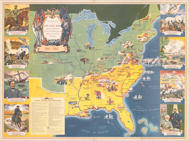
This decorative map chronicling the history of the Civil War was published by Grosset and Dunlap in conjunction with the publication of Otto Eisenschiml, Ralph Newman, and E.B. Long's two-volume The Civil War: The American Illiad. A key at bottom left identifies major places, events, and campaigns, telling the story of the war from John Brown's raid at Harper's Ferry to the surrender of the Florida troops in May 1865. Illustrations across the map depict battles and major events. The Underground Railroad, the Pony Express, and the routes of Morgan's Raid and Sherman's March are traced. Eight vignettes surround the map showing Stonewall Jackson, the Siege of Vicksburg, the sinking of the Alabama, General Philip Sheridan, the bombardment of Fort Sumter, the battlefield at Bull Run, the Battle of Gettysburg, and the surrender at Appomattox. The decorative title cartouche features a Union and Confederate soldier standing in front of their respective flags.
References:
Condition: B+
Issued folding with some minor wear along the folds and a short archivally repaired fold separation at top. There is minute loss at a couple of fold junctions.


