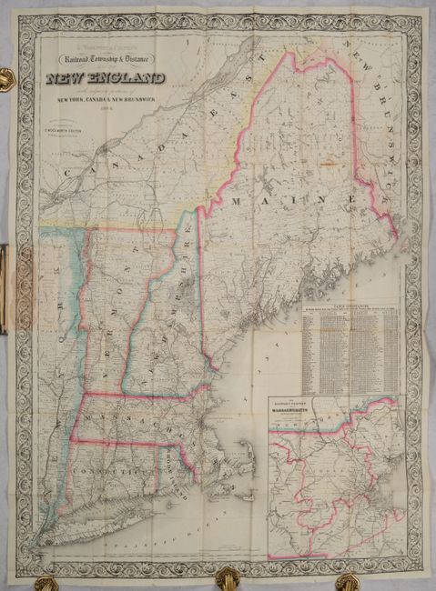
Subject: New England United States
Period: 1864 (dated)
Publication:
Color: Hand Color
Size:
27.5 x 37.7 inches
69.9 x 95.8 cm
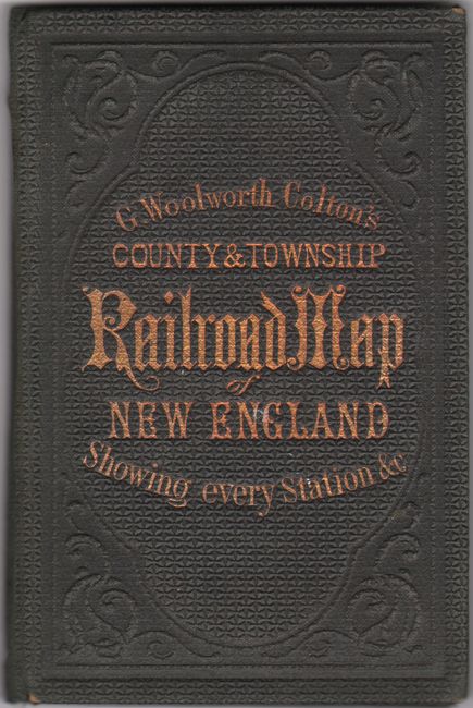
This detailed pocket map of the region extends from Long Island north to Quebec City and New Brunswick. Counties are delineated throughout, and the region's expanding railroad system is traced with bold black lines, with white circles to denote stops. There is an inset at bottom right that zooms in on eastern Massachusetts. Above the inset is a table showing distances between various towns and New York, Hartford, Providence, Boston, Montpelier, Concord, and Augusta. The map is surrounded by an ornate border. Folds into dark green cloth boards (4.0 x 6.0") with gilt title on the front cover.
References:
Condition: B+
Issued folding with a small stain in northern Maine and on the border where the map is attached to the boards (as issued). There are a few short fold separations and an edge tear that enters 0.5" into the bottom border. Covers are lightly worn.