Subject: Colonial Mid-Atlantic United States
Period: 1782 (circa)
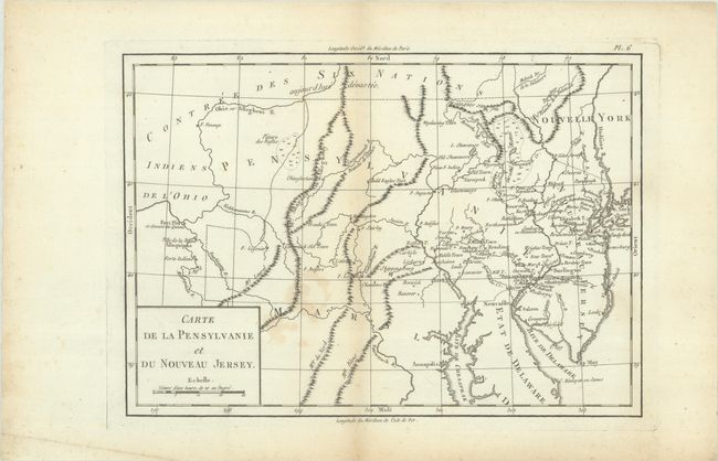
Publication: Essais Historiques et Politiques sur les Anglo-Americains
Color: Black & White
Size:
12.9 x 9.1 inches
32.8 x 23.1 cm
This uncommon Revolutionary War map was issued right around American independence and published in Michel-Rene Hilliard d'Auberteuil's Essais Historiques et Politiques sur les Anglo-Americains. It is centered on Pennsylvania and New Jersey, extending north to "Contree des Six Nations" and south to beyond the Potomac River. Numerous forts are identified in central and western Pennsylvania including Fort Henry, Loudon, Littleton, Shirley and Bedford with Fort Pitt curiously shown beyond the state's western boundary. The more developed areas of eastern Pennsylvania and New Jersey are filled with settlements and towns. Mountain ranges, large rivers, and both a "big swamp" and "buffalo pasture" are also depicted. A block-style title cartouche fills the lower left corner.
References: Howes #H-493; Phillips (Maps) p. 678; Sabin #31899.
Condition: B+
A nice impression on paper with a bunch of grapes watermark. There is some light staining adjacent to the lower centerfold and minor toning along the centerfold and sheet edges.