Catalog Archive
Auction 199, Lot 146

NO RESERVE - Published Just Before West Virginia Seceded

"Johnson's Pennsylvania Virginia Delaware and Maryland", Johnson & Browning

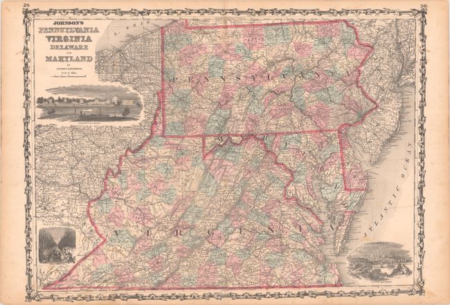
Subject: Mid-Atlantic United States

Period: 1862 (circa)

Publication:

Color: Hand Color

Size:
23.6 x 17 inches
59.9 x 43.2 cm
Download High Resolution Image
(or just click on image to launch the Zoom viewer)

This Civil War era map of the Mid-Atlantic region was issued shortly before West Virginia seceded from Virginia in 1863. It is densely filled with information including counties in hand color, cities and towns, roads, rivers, topography, and more. The map features lovely vignettes of the Lawn at the University of Virginia, City of Baltimore, and the Dismal Swamp Canal. Surrounded by a decorative strapwork border.

References:

Condition: B+

Contemporary color with minor foxing. There is an archivally repaired 4.5" centerfold separation at bottom.

Estimate: $80 - $100

Sold for: $49

Closed on 9/11/2024

Archived