Subject: Mid-Atlantic United States, Civil War
Period: 1864 (circa)
Publication:
Color: Printed Color
Size:
20 x 27.2 inches
50.8 x 69.1 cm
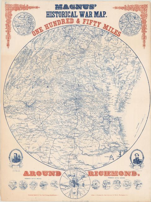
This scarce Civil War map focuses on the theater of war in Virginia. It covers the region from Baltimore south to Raleigh and from the Chesapeake Bay west to beyond Lexington, Virginia. Details include roads, railroads, cities, courthouses, rivers and topography. Surrounding the main circular map are small maps illustrating the base of operations for General Canby (lower Mississippi River) and Sherman (northern Georgia), portraits of generals Ulysses Grant and Robert E. Lee, an inset of fortifications around Richmond, and 10 miniature maps showing "prominent battle grounds" within the 150-mile area including Bethel, Bull Run, Winchester, Antietam, and more. The composition was completed using patriotic red and blue inks and decorative elements in the top corners of the sheet. This is the first edition of this map listed in Stephenson. The map was very popular with the public and went through at least 13 different editions in a very short time period.
References: Stephenson (Civil War) #632.2.
Condition: B+
Issued folding on a bright sheet with three archivally repaired tears at lower right ranging in size from 1.5" to 3.5". There are additional short tears in the margins along the sheet edges that have also been archivally repaired on verso.