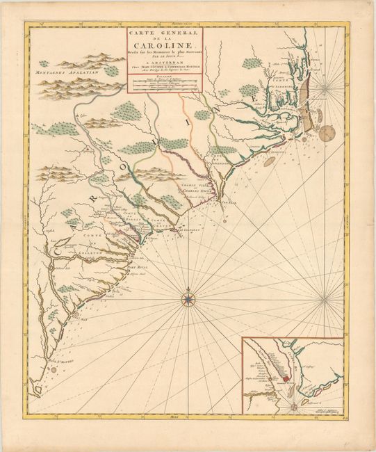
Subject: Colonial Southeastern United States
Period: 1730 (circa)
Publication:
Color: Hand Color
Size:
18.3 x 22.4 inches
46.5 x 56.9 cm
This map depicts present-day North and South Carolina, and was the first map of the Carolinas published outside of England. Despite the title giving credit to Nicolas Sanson, it was derived from Thornton, Morden and Lea's map of 1685 with very few changes. The subtle modifications include place names translated into French, and a previous key naming various plantations around Charleston was replaced with the title cartouche. Cartographically, the map shows good coastal detail, displaying numerous soundings and shoals, as well as inland detail of towns, cities, and mountains in profile. At bottom right is an inset of Charleston surrounded by the Ashley and Cooper Rivers, naming many plantations in the area. Decorated by a compass rose and rhumb lines. Second state of the map with the imprint of Jean Covens and Cornelis Mortier.
References: Burden #767; Cumming (SE) #120.
Condition: A
A crisp impression with full contemporary color on a watermarked sheet with a few minor spots and marginal soiling. There is a tiny tear along the centerfold at right that has been closed on verso with non-archival tape (that is confined to the margin).