Subject: Southern United States, Civil War
Period: 1862 (dated)
Publication:
Color: Hand Color
Size:
52.6 x 30.6 inches
133.6 x 77.7 cm
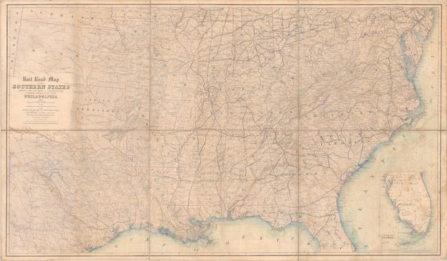
This mammoth Civil War era map extends from just above the Mason-Dixon line south to Florida and west to Texas and the Great Plains. It was prepared by Thomas Kimber, Chairman of the Committee on Inland Transportation of the Board of Trade of Philadelphia, and presents the extensive railroad network in both the Union and Confederacy stretching as far as Missouri and coastal Texas. Existing lines are shown with solid black lines while proposed routes use dashed lines. The map is delineated by county and locates cities and towns, roads, rivers, lakes, mountains, marshes, offshore islands, and more. An inset at bottom right reveals the southern half of Florida. In the west there is early county development in eastern Kansas and Nebraska with both the Territory of Young and Territory of Bexar named in Texas. Self-folding with marbled paper end covers. We found no other examples of this map for sale in the last 30 years.
References: Stephenson (Civil War) #31.5.
Condition: B
There are light dampstains throughout and a faint pencil notation in the image along the bottom border. Dissected and backed on contemporary linen with old library stamps (Cornwall Library) on verso.


