Subject: World
Period: 1780 (circa)
Publication:
Color: Hand Color
Size:
29.8 x 18.6 inches
75.7 x 47.2 cm
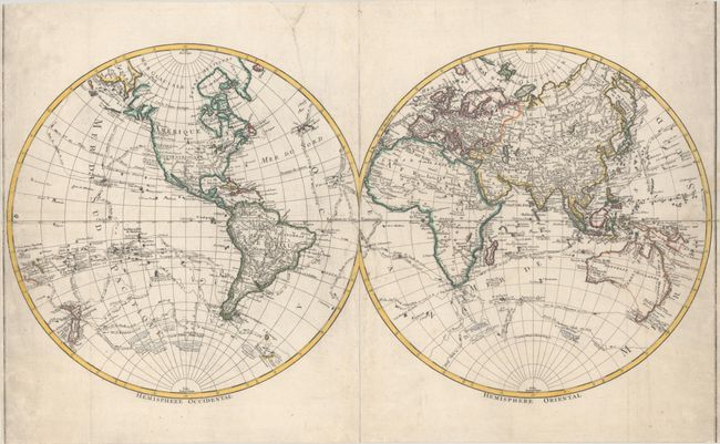
This attractive double hemisphere world map is filled with explorer tracks throughout the oceans, including those of Cook, Furneaux, Byron and Bougainville. Western North America is largely void of detail, but the Alaskan coastline is beginning to take proper shape. Tasmania is still shown attached to the mainland, and the eastern coastline of New Guinea is incomplete. New Zealand is fully formed. The Pacific Islands are shown in good detail including the Sandwich Islands, where it is noted that Cook was killed in 1779. Numerous islands composed of ice are shown just off of Antarctica.
References:
Condition: B
Issued folding on "MC" watermarked paper that has been professionally flattened and backed with tissue. There is light soiling along the right and left sheet edges and archival repairs to a chip and associated 3.5" edge tear in the top margin. The border has been trimmed away at top and bottom.