Subject: Arizona
Period: 1948 (dated)
Publication:
Color: Printed Color
Size:
16.1 x 20.4 inches
40.9 x 51.8 cm
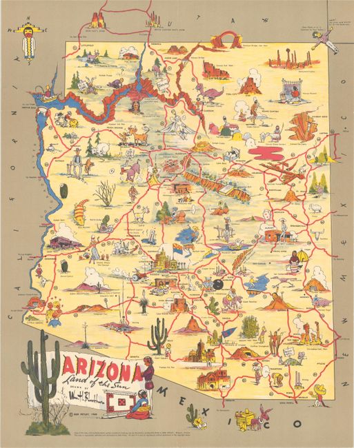
This colorful pictorial map promoting the state was drawn by William Blackburn and published by Bob Petley in Phoenix. It shows the state's highway network in red and is filled with cartoonish characters and playful illustrations highlighting the state's attractions including natural wonders, points of interest, historical sites, and much more. A few highlights include the Grand Canyon, Mogollon Rim, Painted Desert (complete with paint can), gold mining, rodeos, and much more. Decorated by a banner-style title cartouche flanked by Native Americans and a cactus. We found two past sales records and no institutional examples on OCLC.
References:
Condition: A
A colorful example with two very short archivally repaired fold separations along the top and bottom edges. Previously folded and now flat.


