Subject: Berkeley, California
Period: 1910 (circa)
Publication:
Color: Black & White
Size:
16 x 25 inches
40.6 x 63.5 cm
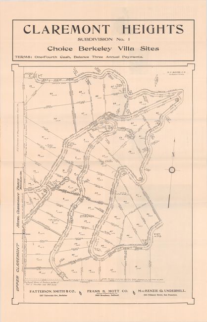
This very rare plat map by Berkeley city engineer Wilbur F. McClure shows the proposed subdivision of Claremont Heights, now the district known as Claremont Hills. According to the promotional text on verso, "Claremont Heights is a portion of two hundred acres just back of the Million Dollar Claremont Hotel, and a short distance from the business centers of Berkeley and Oakland. This district is destined to be the finest residence district of Berkeley. The tract for the Claremont Hotel can be seen along the map's western edge; the hotel was still under construction at the time of publication, not to be completed until 1915. The terms offered for plots of land are one-fourth cash up front, with the remaining balance to be paid off in three annual payments, with villa sites going for $800-3500. In addition to the promotional text on verso, there are black & white photographs and an illustrated bird's eye view of the land. Along the bottom of the map are the investors: Patterson, Smith & Co., Frank K. Mott Co. (Mott would have been mayor of Oakland at the time of publication), and MacKenzie & Underhill. David Rumsey has a similar map with a map of Berkeley on the verso and only Patterson, Smith & Co. named at bottom; otherwise, we can find no other recorded copy of this map. Folds into illustrated stiff paper covers (3.8 x 9.4").
References: cf. Rumsey #5317.
Condition: B+
Issued folding with a few splits at the fold junctions with a couple of tiny chips at the top junction. Paper covers have light wear around the edges and minor soiling.


