Catalog Archive
Auction 199, Lot 19

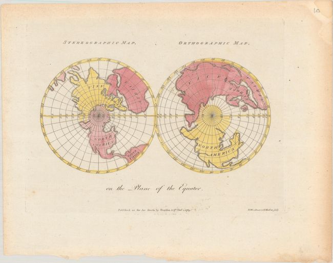
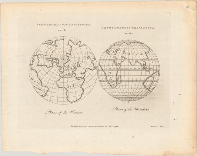
"[Lot of 2] Stereographic Map. Orthographic Map. On the Plane of the Equator [and] Stereographic Projection, on the Plane of the Horizon / Orthographic Projection, on the Plane of the Meridian", Harrison, John

Subject: World

Period: 1783-84 (dated)

Publication: The Geographical Magazine

Color:

Size:
7.1 x 4.8 inches
18 x 12.2 cm
Download High Resolution Image
(or just click on image to launch the Zoom viewer)

This lot includes two plates from William Fordyce Mavor's The Geographical Magazine; or, A new, copious, compleat and universal system of geography, which was published in several editions between 1782-94. Each plate includes two different projections, one stereographic and one orthographic, of the earth from different perspectives. Geographic detail is minimal, with only basic outlines of continents, each of which is labeled, and a few major rivers shown. Both plates were engraved by T.I. Woodman and Henry Mutlow.

A. Stereographic Map. Orthographic Map. On the Plane of the Equator, dated 1783, hand color.

B. Stereographic Projection, on the Plane of the Horizon / Orthographic Projection, on the Plane of the Meridian, dated 1784, black & white.

References: McCorkle (18th C. Geography Books) #268 [2 & 3].

Condition: B+

Crisp impressions with light toning and just a few spots of foxing.

Estimate: $140 - $170

Sold for: $100

Closed on 9/11/2024

Archived