Catalog Archive
Auction 199, Lot 20

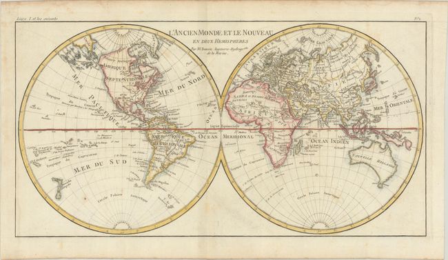
"L'Ancien Monde et le Nouveau en Deux Hemispheres", Bonne, Rigobert

Subject: World

Period: 1785 (circa)

Publication: Atlas de Toutes les Parties Connues du Globe Terrestre

Color: Hand Color

Size:
16.3 x 8.5 inches
41.4 x 21.6 cm
Download High Resolution Image
(or just click on image to launch the Zoom viewer)

Attractive double hemisphere world map. In North America, the United States is named and confined along the eastern seaboard. The entire western region is blank with the only place names being Santa Fe and Cape Mendocino. There is a large group of islands in the North Pacific including Alaschka in the vicinity of Alaska. Tasmania is attached to Australia, and both islands of New Zealand are depicted.

References:

Condition: B+

Issued folding with light offsetting and soiling. There are dampstains along the edges of the sheet, entering the map border a bit at left.

Estimate: $140 - $170

Sold for: $90

Closed on 9/11/2024

Archived