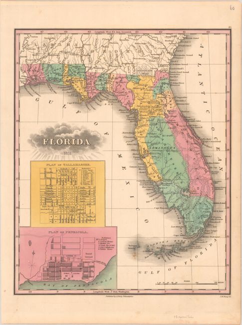
Subject: Florida
Period: 1831 (dated)
Publication: A New General Atlas
Color: Hand Color
Size:
9.4 x 11.4 inches
23.9 x 29 cm
Finely's maps employ a delicate and elegant engraving style and provided extensive topographical and watershed information. He was the dominant map maker in the United States in the early 1820s into the 1830s. His atlases were very successful, outselling rival atlases by Carey & Lea, and Tanner. His maps were printed on high quality paper and were routinely corrected and updated.
This is the rare first state of Finley's New General Atlas map of Florida. Florida didn't become a state until 1845, and this is one of the earliest maps of the territory to appear in a commercial atlas. The majority of the peninsula is comprised of the large Alachua, Mosquito, and Monroe counties, with a region in the center labeled Seminoles and Indian Reserve. Some early roads are shown in the northern half of the peninsula. The map includes large insets of plans of Tallahassee and Pensacola. In 1826, Finley issued a more rudimentary Florida map in both pocket format and in his A New American Atlas, his attempt to complete Tanner's American Atlas. The earlier 1824 and 1826 editions New General Atlas did not include a Florida map. This is only the fourth standalone example of this map that we have seen on the market.
References: Ristow, pp. 268-70.
Condition: B+
Bold contemporary color with a few small spots and minor marginal toning.


