Subject: World
Period: 1787 (circa)
Publication: Bankes's New, Royal, and Authentic System of Universal Geography
Color: Hand Color
Size:
18.1 x 12.7 inches
46 x 32.3 cm
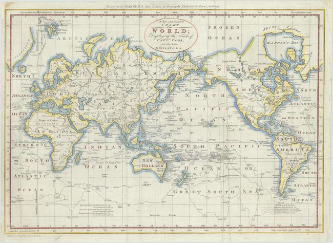
This fascinating map of the world is filled with Captain Cook's tracks from all three voyages. A key at bottom right corresponds the various tracks to each voyage. In North America, there is a fictitious West River, while Alaska is shown with a fairly correct shape. A note on the northwest coast of the continent mentions Fou-sang, a mythical Chinese colony allegedly established in the 5th century. The Sandwich Islands are shown and noted as the place where Capt. Cook was killed. The South Pacific is filled with islands, and New Zealand is fully formed. Tasmania is still attached to Australia, which is shown with an incomplete southern coastline. There are numerous detailed notations throughout. This is the first state of the map with "Engraved for Banke's New System of Geography" above the top neatline.
References: McCorkle (18th C. Geography Books) #11-2; Phillips (Maps) p. 1094.
Condition: A
A crisp impression on a bright sheet with a pressed crease at right and a tiny repaired chip in the top left blank margin. Issued folding and now flat.