Subject: Hawaii
Period: 1935 (circa)
Publication:
Color: Printed Color
Size:
23.4 x 9.1 inches
59.4 x 23.1 cm
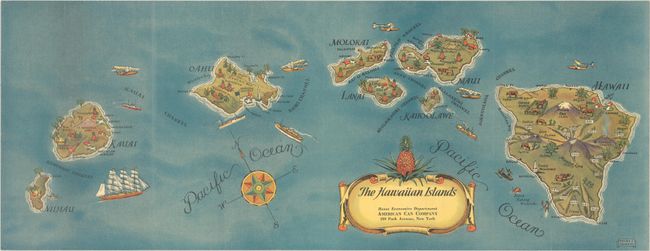
This lovely pictorial map of Hawaii was designed by Stephen J. Voorhies for the American Can Company. The map shows pineapples, cattle, airports, sugarcane fields, coconut trees, volcanoes, Pearl Harbor, Cook's Monument, a cannery on Maui, and more. Airplanes, various watercraft, and a compass rose decorate the Pacific blue between islands. The title cartouche is capped by a large pineapple. The map also appeared as the folding covers to a booklet on the pineapple industry, under the alternate title The Hawaiian Islands and the Story of Pineapple.
References:
Condition: A
A bright example issued folding, now flat, with minor abrasions and creases to the sheet's glossy finish.


