Subject: Indiana
Period: 1824 (published)
Publication: A New General Atlas
Color: Hand Color
Size:
8.7 x 11.3 inches
22.1 x 28.7 cm
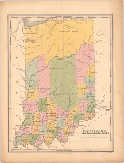
Finely's maps employ a delicate and elegant engraving style and provided extensive topographical and watershed information. He was the dominant map maker in the United States in the early 1820s into the 1830s. His atlases were very successful, outselling rival atlases by Carey & Lea, and Tanner. His maps were printed on high quality paper and were routinely corrected and updated.
Fine early map of the state with only 38 counties. The top third of the state is unorganized beyond the Wabash River and the Indian Boundary with reference to Ottaway, Miami, Delaware, and Pottawatomie Indians. The detailed map shows the roads, towns and settlements with most of the settlements and roads in the lower third of the state. Finely engraved by Young & Delleker.
References:
Condition: B+
Attractive contemporary color with very faint offsetting and one small spot.