Subject: Louisville, Kentucky
Period: 1934 (dated)
Publication:
Color: Printed Color
Size:
22 x 16.2 inches
55.9 x 41.1 cm
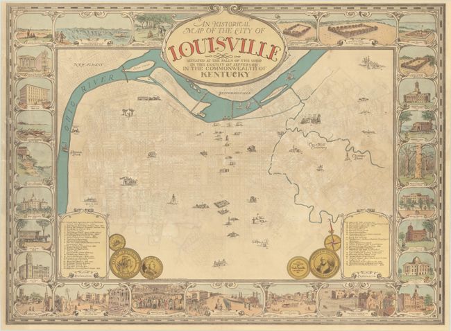
This charming pictorial map of Louisville was created by Karl Smith and highlights important sites and historical events in the city. Forty-five locations are illustrated on the map over a street-plan view and explained in a numbered key in the bottom corners of the map. Surrounding the map are small vignettes of events and structures that further illustrate the rich history of the city, such as Thomas Bullitt laying out the town in 1773, La Salle viewing the Falls of the Ohio in 1669, the founding of the University of Louisville in 1846, and General Buell's troops landing at Louisville in 1862. Medallion portraits of General George Rogers Clark, the founder of Louisville, and Louis XVI, for whom the city was named, are included at the bottom of the map. A rare issue.
Karl J. Smith (1895-1986) was a native of Louisville, Kentucky, and spent his career as an artist, cartographer and advertising manager. He honed his design skills while working in advertising for the Louisville Paper Company, which was run by his uncle, Thomas Floyd Smith III, and later served as advertising director at Dillard Paper Co. in Greensboro, North Carolina. Smith is best known for his pictorial maps, including one of the first pictorial maps of Kentucky, the game board map for "The Little Colonel Game" (based on the 1935 movie), a map of Abraham Lincoln's life, and a series of pictorial maps of the states commissioned by the Speed Art Museum in Louisville.
References:
Condition: B+
Light soiling and small abrasions in the image. The map has been professionally backed in archival tissue to repair a 3" tear at top center and several short splits due to the map having been folded horizontally and vertically by a previous owner.


