Subject: Eastern Massachusetts
Period: 1853 (dated)
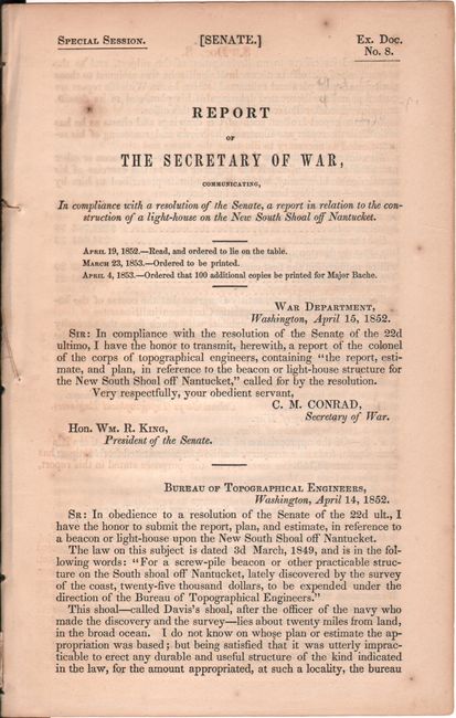
Publication: Sen. Ex. Doc. No. 8, Special Session
Color: Black & White
This lot features four early Coast Survey charts of Martha’s Vineyard and Nantucket including:
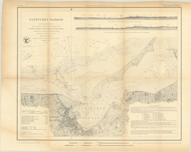
A. Nantucket Harbor (17.5 x 14.3"). This detailed nautical chart is filled with soundings, bottom types, rocks, buoys, and other navigational information. A table at bottom left includes notes on the tides, and extensive sailing directions appear at bottom right. The town is shown in plan form, and there is nice topographical detail along the coasts. Coatue Beach is named. There are two approach views across the top.
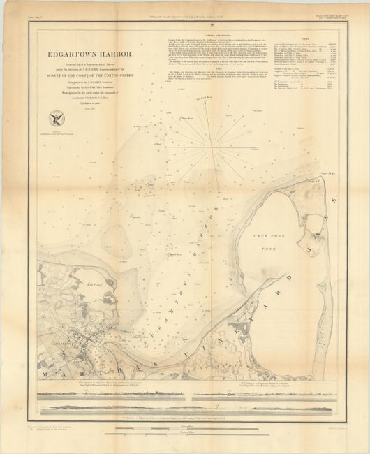
B. Edgartown Harbor (14.1 x 17.6"). An attractive chart with good detail on land as well as the coastline. Filled with hundreds of soundings, anchorages, hazards, bottom type and light houses. At bottom are three profile views showing the entrance to Edgartown Harbor.
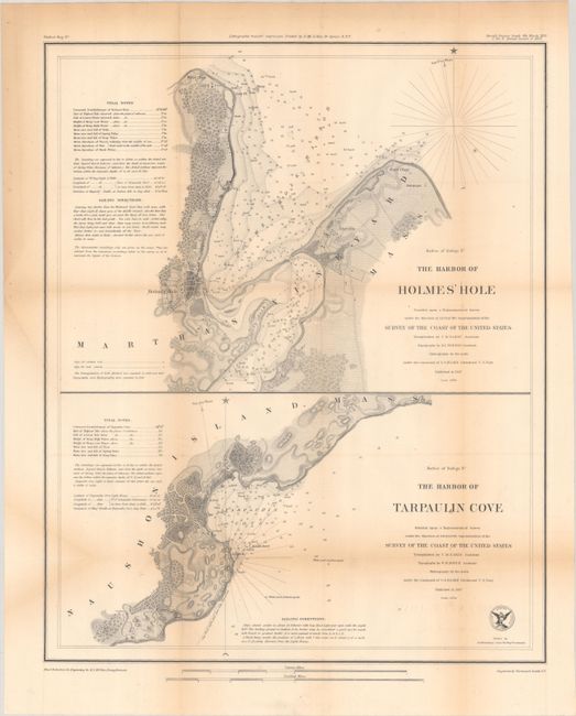
C. The Harbor of Holmes' Hole [on sheet with] The Harbor of Tarpaulin Cove, (14.2 x 17.5"). Two charts on one sheet. The top chart covers the northern part of Martha's Vineyard around today's Vineyard Haven, while the bottom chart depicts part of the eastern coast of Naushon Island.
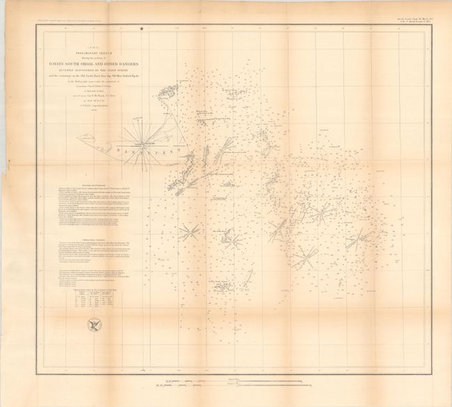
D. Preliminary Sketch Showing the Positions of Davis's South Shoal and Other Dangers..., (19.4 x 17.3"). A highly detailed chart depicting the dangerous Nantucket Shoals to the southeast of the island that were discovered from 1846-52. Names a number of new shoals, shoal spots, Old Man's Shoal, Mr. Blair's Shoals, Point Rip, and more.
Accompanied by the 59-page Senate report concerning the construction of a light house off of Nantucket to address the treacherous areas. In addition to the maps, there are 4 single-page plates with drawings of beacons and lighthouses. Disbound.
References:
Condition: B+
Issued folding with light toning, minor foxing, and faint offsetting. There is some creasing at lower left where the maps were folded into the report. Disbound text has some light toning and minor foxing.