Subject: New Jersey
Period: 1834 (dated)
Publication: A New Universal Atlas
Color: Hand Color
Size:
12.6 x 15.1 inches
32 x 38.4 cm
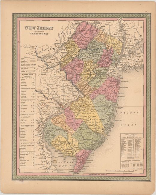
A handsome county map with good detail throughout locating numerous towns and villages, rivers, canals, and railroads, with distances along major wagon roads. Tables at bottom right name the counties and county seats with populations in 1830 and 1840. Steamboat and stagecoach routes from Trenton are given in several tables at left. The map copyright date is 1834, but county configuration reflects the New Jersey of 1850, with the addition of Ocean County from Monmouth County. It was published by Thomas, Cowperthwait & Co. in the 1850 edition of Samuel Augustus Mitchell's A New Universal Atlas.
References: Rumsey # 4835.019.
Condition: B+
Full contemporary color on a lightly toned sheet with faint foxing, minor soiling and a few small chips along the edges of the sheet.