Subject: Oregon
Period: 1889 (dated)
Publication:
Color: Hand Color
Size:
27.4 x 23.2 inches
69.6 x 58.9 cm
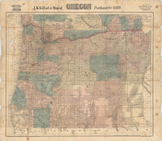
This very detailed pocket map depicts the extent of development in the state, which had been almost entirely surveyed at this point as indicated by the grids that stretch across much of the state. The map identifies county seats, towns and post offices, railroads, stage routes, lighthouses, Indian reservations, and military reservations. Topography is well rendered via hachure. Compiled and drawn by civil engineer W.H. Galvani, with up-to-date corrections by George Stowell and John Gill. Joseph Kaye Gill owned an office supply company specializing in books and school supplies based in Portland. He published only a handful of maps focused on Oregon and Washington, which were updated as the region developed. The company, however, existed until 1999 when it was forced to close due to competition. This example does not include cloth-covered boards.
References:
Condition: C+
Issued folding with numerous short splits at the fold junctions, moderate staining and soiling, and a hole in an unengraved section at left.


