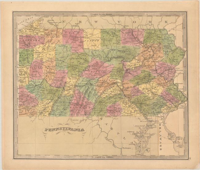
Subject: Pennsylvania
Period: 1840 (published)
Publication: A New Universal Atlas
Color: Hand Color
Size:
12.6 x 10.8 inches
32 x 27.4 cm
This handsome atlas map of the state shows early county development and includes portions of the Delaware and Chesapeake bays. The early roads and railways are noted, and many towns and cities are named. County configuration predates the establishment of Monroe County in 1836. The map is surrounded by a keyboard-style border and features fancy titling. Jeremiah Greenleaf took over the production of David Burr's New Universal Atlas when Burr was appointed Geographer of the House of Representatives in 1838.
References: Phillips (Atlases) #784-39; Rumsey #4850.039.
Condition: B+
Full contemporary color on a lightly toned sheet. A small chip in the bottom right blank margin has been repaired with archival materials.