Subject: Beaufort, South Carolina
Period: 1861 (circa)
Publication:
Color: Printed Color
Size:
11.9 x 9.1 inches
30.2 x 23.1 cm
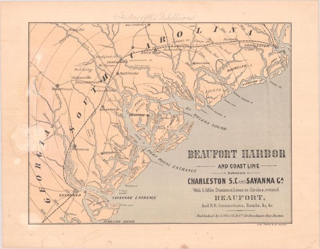
This Civil War era map is centered on Beaufort and extends to Savannah in the south and Charleston in the north, which are linked together by an inland railroad via Salkehatchie. It presents good detail of the coastline, islands, rivers, towns, and wagon roads in the region. Names forts Sumter, Jackson and Pulaski along the coast, but not Walker and Beauregard in the immediate vicinity of Beaufort. Concentric circles radiate out of Beaufort at 5 mile intervals. This is a variant to the Stephenson reference with no ships in Beaufort Harbor or printed text above/below the map.
Beaufort Harbor was strategically located between two important Confederate cities, and became a Union target early in the Civil War. This map, without the Union blockade shown in the water, was likely published prior to the Battle of Port Royal in November 1861, when Union forces seized control of the area. We found no other examples of this variant map for sale in the last 30 years.
References: cf. Stephenson (Civil War) #368a.
Condition: B
There are a few dampstains along the left border and a pencil notation in the top blank margin.


