Subject: Northern Texas, Dallas
Period: 1925 (circa)
Publication:
Color: Printed Color
Size:
16 x 22.3 inches
40.6 x 56.6 cm
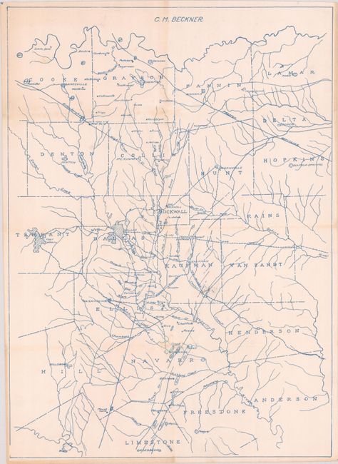
Drawn in blue ink by C.M. Beckner, this oil map covers north Texas from Waco to the Red River, including Dallas and Fort Worth. It locates oil wells primarily in Navarro and Limestone counties as well as a few to the north in Cooke County. Of particular interest are the wells around Corsicana, which were discovered in 1894 and considered to be some of the earliest commercial operations in Texas. The map also locates other geological features including the Preston Anticline, Ellenburger formation, and the Balcones Fault. Other details include several railroads, numerous rivers and creeks, and small cities and towns scattered throughout.
References:
Condition: B+
Issued folding with minor soiling and archival repairs to a few tiny splits at the fold junctions. There are some minor pencil notations at center.


