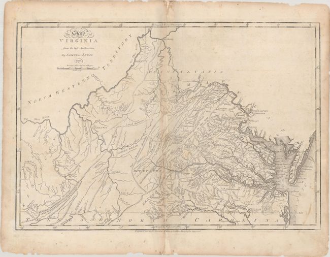
Subject: Virginia
Period: 1794 (dated)
Publication: Guthrie's Geography
Color: Black & White
Size:
20.3 x 13.9 inches
51.6 x 35.3 cm
This early map is notable as being "the first map of Virginia to be engraved, printed, and published in the United States" (Stephenson & Mckee). It was drawn by Samuel Lewis, engraved by James Smither, and published by Matthew Carey in several different works. The map first appeared in 1794 in Carey's edition of Jefferson's Notes on Virginia, the first American edition of that work to include a map. In 1795, it appeared in the American edition of Guthrie's Geography as offered here, and then again in editions of Carey's American Atlas and General Atlas. The map is finely engraved and filled with details including rivers, mountains, towns, county names, courthouses and more. It shows the large Kentucky County in the west (which was actually divided into Lincoln, Fayette and Jefferson counties in 1780) and Northwestern Territory filling the region north of the Ohio River. Lewis notes major roads in the eastern half of the state, locates a lighthouse at Cape Henry (built in 1792), and names Burwell's Ferry, an important location for Williamsburg commerce. Washington is the "Federal City."
References: Phillips (Atlases) #1172-13; Phillips (VA) p. 65; Stephenson & Mckee, p. 56 & p. 93; Wheat & Brun #678; Wooldridge pp. 186-91.
Condition: B
A nice impression with light soiling that is more prominent along the centerfold. There are a number of centerfold separations and a small chip at center that have all been archivally repaired on verso. Several small edge chips are confined to the top and bottom blank margins.


