Subject: Southeastern Mexico
Period: 1874 (dated)
Publication:
Color: Black & White
Size:
38.1 x 23.9 inches
96.8 x 60.7 cm
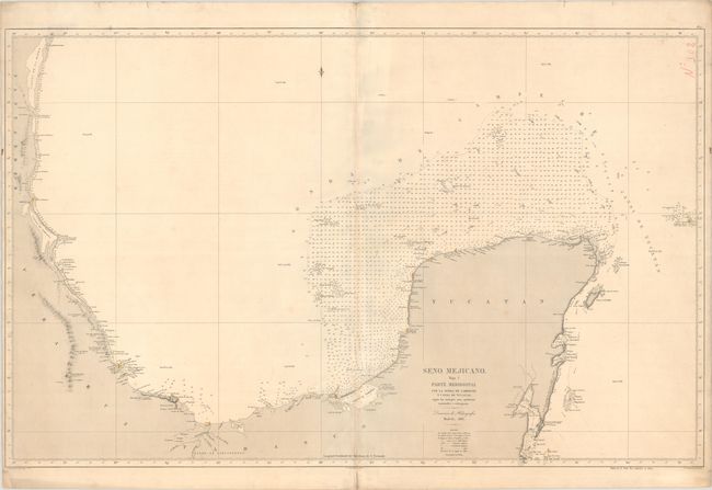
This uncommon sea chart depicts the western Gulf of Mexico and Mexican coastline including Tampico, Vera Cruz, the Yucatan Peninsula, Cozumel, and the far western tip of Cuba. It presents excellent navigational detail along the coastlines including hundreds of soundings, hazards, currents, ground types and lighthouses, which have been hand colored in red and yellow. Embossed with the stamp of the Direccion de Hidrografia in Madrid at upper right. Spanish sea charts are among the finest, and scarcest of all working charts. They are uncommonly offered on the market. Dated 1866 and corrected to 1874.
References:
Condition: A
A crisp impression with some faint creasing along the centerfold, minor soiling along the sheet edges, and a few short edge tears in the margins that have been archivally repaired on verso. There is a small manuscript notation at top right. An excellent example for this type of chart.