Catalog Archive
Auction 199, Lot 299

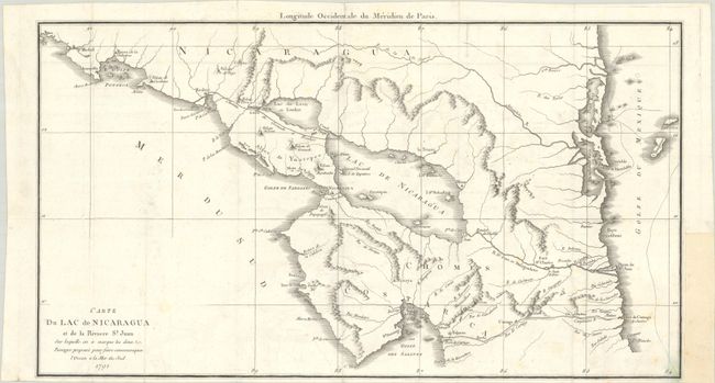
"Carte du Lac de Nicaragua et de la Riviere St. Juan sur Laquelle on a Marque les Deux Passages Proposes pour Faire Communiquer l'Ocean a la Mer du Sud"
Subject: Nicaragua

Period: 1791 (dated)

Publication: Histoire Abregee de la Mer du Sud

Color: Black & White

Size:
21.3 x 11.9 inches
54.1 x 30.2 cm
Download High Resolution Image
(or just click on image to launch the Zoom viewer)

This scarce map depicts the two proposed canal routes through Nicaragua to navigate from the Gulf of Mexico to the Pacific Ocean. There is excellent detail of the rivers and topography in the region. This map appeared in the monograph Memoires sur la Possibilite, les Avantages et les Moyens d'Ouvrir un Canal dans l'Amerique Septentrionale, pour Communiquer de la Mer Atlantique, ou du Nord, a la Mer Pacifique, ou du Sud by Martin de la Bastide, which was published in Jean-Benjamin de La Borde's Histoire Abregee de la Mer du Sud.

References:

Condition: B+

A crisp impression issued folding on watermarked paper with light offsetting and faint foxing. There is a binding trim in the right blank margin that has been replaced with old paper.

Estimate: $160 - $190

Unsold

Closed on 9/11/2024

Archived