Subject: Portobelo, Panama
Period: 1772-88 (published)
Publication:
Color: Hand Color
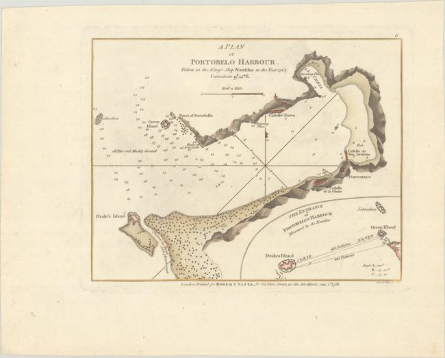
A. A Plan of Portobelo Harbour. Taken in the King's Ship Nautilus in the Year 1767..., by Robert Sayer, dated 1788 (8.8 x 6.9"). This lovely and uncommon small chart depicts the historic Panamanian harbor, showing Castello Nueva, Castello de San Jeronimo, Castello de la Gloria, and iron castle ruins along the coast. There is plenty of navigational information, including depth soundings, hazards, notes on bottom type, and an anchorage. An inset details The Entrance of Portobello Harbour at bottom right. Engraved by Creed & Wigzell. Trimmed from a larger sheet with another standalone chart of Zispata Bay. Reference: cf. Phillips (Maps) p. 728; cf. Shirley (BL Atlases) M.SAY-4a #6. Condition: On a sturdy sheet with a fleur-de-lis coat of arms watermark and marginal soiling. (A)
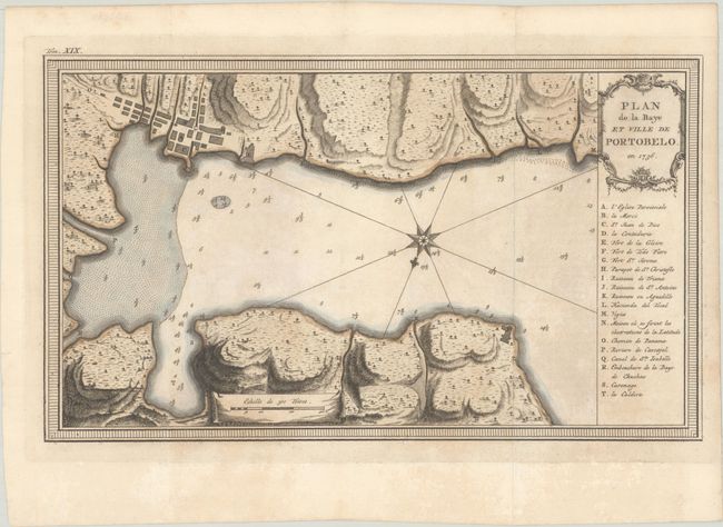
B. Plan de la Baye et Ville de Portobelo. En 1736, by Jacques Nicolas Bellin, from Histoire Generale des Voyages, published 1772 (12.6 x 7.4"). This attractive chart shows Portobelo, the important Spanish port city on the northern coast of Panama. Numerous soundings are located, and a key at right identifies important locations. The chart is surrounded by a boldly engraved border. Not in Kapp's carto-bibliography of Panama. Condition: A crisp impression issued folding, now flat, on watermarked paper with light toning. (B+)
References:
Condition:
See description above.


