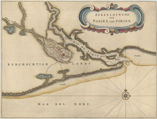
Subject: Paraiba, Brazil
Period: 1644 (published)
Publication: Historie ofte Iaerlijck Verhael van de Verrichtinghen der Geoctroyeerde West-Indische Compagnie...
Color: Hand Color
Size:
13.4 x 10.2 inches
34 x 25.9 cm
This rare map shows the region of Paraiba and Portuguese fortifications at the mouth of the River Paraiba. It features a compass rose capped with a fleur-de-lis and a handsome strapwork cartouche. Published in de Laet's account of the history of the Dutch West India Company from its beginnings to 1636. It served as the model for more common maps with the same title by Isaac Commelin and Gregorio Leti, which added naval battle scenes depicting the Dutch fleet and the defending Portuguese armies.
References: Phillips (Atlases) #3647.
Condition: B
A crisp impression issued folding, now flat, on paper with a jester watermark. The sheet has been trimmed close to neatline on all sides and has minor extraneous creasing.


