Subject: Chile
Period: 1744 (dated)
Publication:
Color: Hand Color
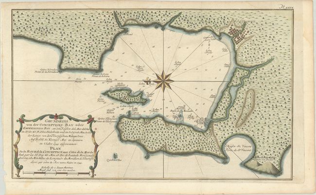
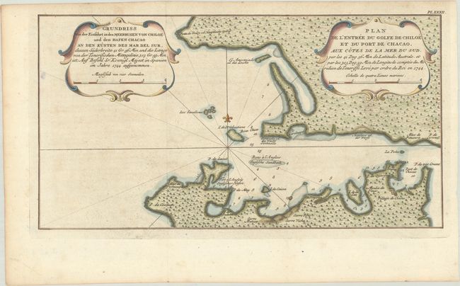
This pair of rare maps appeared in a 1752 French edition of Antonio de Ulloa and Jorge Juan's Relacion Historica del Viaje a la America Meridional..., a seminal work on South American geography, culture, and history written by the two scientists after nearly a decade spent exploring the continent. Spaniards Ulloa and Juan were appointed to the French Geodesic Mission to South America. The purpose of the mission was to measure a degree of meridian arc at the equator, and the chosen location for the measurements was Ecuador. The measurements would then be compared with similar measurements made near the North Pole, with the goal of determining the true shape of the earth.
The first chart, Grundriss von der Conceptions-Bay oder Empfaengniss-Bay... / Plan de la Baye de la Conception aux Cotes de la Mer du Sud... (14.5 x 8.8"), depicts Concepcion Bay with north oriented to the left. The city of Concepcion is shown in its original location, before it was moved in the aftermath of the famous earthquakes of 1750 and 1751. The second chart, Grundriss von der Einfahrt in den Meerbusen von Chiloe und den Hafen Chacao... / Plan de l'Entree du Golfe de Chiloe et du Port de Chacao... (14.4 x 7.6"), focuses on the Chacao Channel, with Village de Chacao rendered in minature plan form. Both charts feature soundings, anchorages, banks, inland topographical detail, and titles in both French and German.
References: cf. Shirley (BL Atlases) G.ULL-1a.
Condition: B+
Crisp impressions issued folding, now flat, with minor offsetting and foxing. The Concepcion Bay sheet has light dampstaining along the top edge of map image.