Subject: North Atlantic
Period: 1650 (circa)
Publication: Atlas Novus
Color: Hand Color
Size:
22.3 x 17.2 inches
56.6 x 43.7 cm
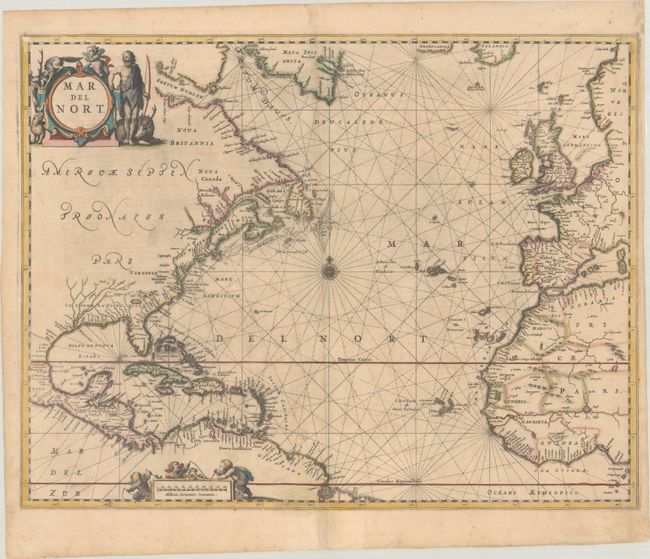
This map was originally published in Jansson's important sea atlas, Atlantis Majoris Quinta Pars, Orbem Maritimum, the first of its kind intended for the general market, and then incorporated into his later publications. The chart covers the northern Atlantic Ocean with the eastern coast of North America, the West Indies, and the coasts of Europe and North Africa. Cartographically it is based on the previous maps produced by Hondius and Jansson, with a few notable improvements. The single Great Lake is replaced by a lake full of large islands and a complex system of waterways feeding the St. Lawrence River. There is a significant improvement in the delineation of the coastline between Chesapeake Bay and Long Island and in the north it shows Groenlandia separated by Meta Incognita. Penobscoi is named in present-day Maine for Penobscot Bay, and C. Cod is noted as well, in what becomes Massachusetts. The handsome chart is arrayed with rhumb lines radiating from a central compass rose, and the title and distance scale cartouches feature a Native American, several putti, and a variety of indigenous animals. Latin text on verso, published in 1650 or 1659.
References: Burden #290; Van der Krogt (Vol. I) #0101:1.
Condition: B+
A crisp impression with full contemporary color on a sheet with very light toning, some printer's ink residue, and light soiling. There are old paper repairs to a centerfold separation at bottom and several short tears along the edges of the sheet. The right margin has been extended a bit at top to accommodate framing.