Reduced Version of Zeno Map with Mythical Islands
"Septentrionalium Partium Nova Tabula", Ruscelli, Girolamo
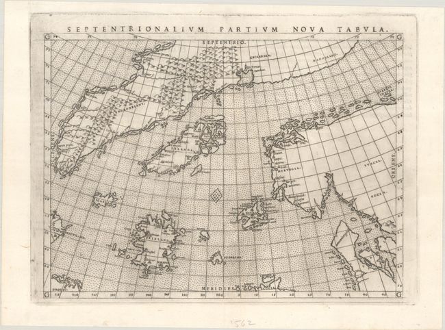
Subject: Arctic & Scandinavia
Period: 1564 (published)
Publication: Geographia Cl. Ptolemaei Alexandrini
Color: Black & White
Size:
9.7 x 7.1 inches
24.6 x 18 cm
This is a reduced version of the landmark Zeno map showing the mythical islands in the North Atlantic and small coastlines of Labrador (Estotiland) and possibly Newfoundland (Drogeo). Frisland is depicted in considerable detail, with many place names indicated. The only cartographic difference between this and the woodcut map published by Zeno is that there is no land bridge between Greenland and Scandinavia on this edition. First state with Latin text on verso.
In 1558, Nicolo (the Younger) Zeno claimed to have discovered a 14th century manuscript recording a voyage made by his ancestors Nicolo and Antonio. According to the text, in the year 1380 a storm swept the Zenos into the North Atlantic where they found a group of unknown lands named Frisland, Estotiland, Estland, Icaria, and Drogeo. As a result, maps throughout the 16th century continued to show these fictional islands, especially Frisland. Read more about the Zeno brothers and their mythical islands here.
References: Burden #29; Ginsberg #18; Manasek #19; Mickwitz & Miekkavaara #218-26.
Condition: A+
A dark impression on a bright sheet with a medallion watermark and a bit of printer's ink residue.