Subject: Western England
Period: 1646 (circa)
Publication: Atlas Novus
Color: Hand Color
Size:
19.8 x 14.8 inches
50.3 x 37.6 cm
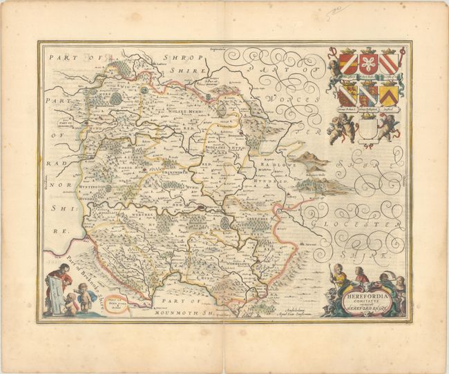
This beautiful map of Herefordshire is engraved with delicately rendered forests, parks, mountains, and towns. The map centers on Hereford and extends from Ludlow south to Monmouth and from Hay-on-Wye to the Malvern Hills, which are prominently depicted on the eastern edge of the map. There is a title cartouche at bottom right featuring shepherds and their flock, and a scale of miles at bottom left that is attended by a surveyor and a pair of putti. The crests of prominent families are shown at top right. Latin text on verso, published between 1646-59.
References: Van der Krogt (Vol. I) #5510:1.2.
Condition: B+
A nice impression with a centerfold separation entering 2" into the map image at bottom that has been closed on verso with hinge tape. There are a couple light dampstains at bottom and minor foxing in the blank margins.