Catalog Archive
Auction 199, Lot 380

"A Mapp of ye County of Lincolne, wth Its Divisions, & Hundreds: or Wapontacks", Blome, Richard

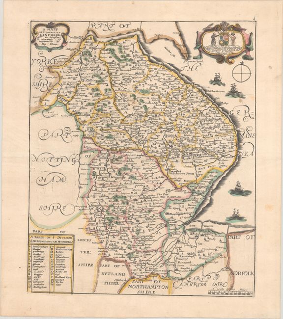
Subject: Eastern England

Period: 1673 (circa)

Publication: Britannia

Color: Hand Color

Size:
10.6 x 12.9 inches
26.9 x 32.8 cm
Download High Resolution Image
(or just click on image to launch the Zoom viewer)

This handsome map of Lincolnshire was issued in Blome's Britannia: Or, A Geographical Description of the Kingdoms of England, Scotland, and Ireland. Shirley describes the maps in this work as "based on those by John Speed but reduced in size." It divides the county into hundreds and names several towns and cities, including Lincoln, Boston, Grimsby, Tattershall, Sleaford, and Thornton. There is nice topographical detail of rivers, hills, parks, fens, and more. The dedicatory cartouche at top right honors Robert Bertie, Lord Willoughby de Eresby, and includes a charming coat of arms. The map is further adorned with a strapwork title cartouche, a table showing the hundreds, and a scale of miles.

Richard Blome was one of the most interesting, and most active, publishers of illustrated books in post-Restoration London. He is most renowned for what his contemporaries considered the plagiarism of the maps in the Britannia from Camden and Speed. In actuality Blome did not claim that the maps were original works, and the atlas filled an important gap in the market. In the preface he wrote, "I do not own myself the Author, but the Undertaker of this work". He was one of the most active publishers of illustrated books in post-Restoration London and his career provides in insight into the nature and activities of the London map and print trade of the period. There is an excellent biography on MapForum.com.

References: Shirley (BL Atlases) T.BLOM-2a.

Condition: A

A nice impression on a sheet that has been backed with linen. There are a couple minor spots and light printer's ink residue.

Estimate: $160 - $190

Unsold

Closed on 9/11/2024

Archived