Subject: London, England
Period: 1934 (circa)
Publication:
Color: Printed Color
Size:
28.1 x 18.9 inches
71.4 x 48 cm
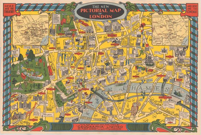
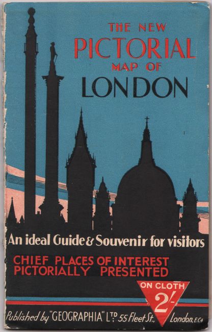
This vibrant pictorial map of London extends from Hyde Park and Albert Hall in the west to the Tower of London in the east, and from Regents Park in the north to the Tate Gallery and Elephant and Castle in the south. The map has an appealingly irreverent tone: the zoo at Regents Park contains "the Nunkphoo, the lesser Ooglespiff, the Wambling Wotsit;" a melting figure escapes Madame Tussaud's exclaiming "I got waxy and ran away!;" the tourist is encouraged to visit Victoria and Albert Museum "for more cheap china!;" a man chips away at Waterloo Bridge singing "Waterloo Bridge is falling down" (the bridge was of course replaced in the 1930s). To counterbalance the jokes, there are marvelous illustrations of notable architecture and helpful insets showing all the theatres and cinemas (with nearby underground stations noted). This is a later example, with the addition of the insets and a decorative border. Backed in linen, as issued. Folds into illustrated stiff paper covers (4.5 x 7.0").
References: cf. Rumsey #9989.
Condition: A+
A vivid example. Paper covers have light wear to spine and edges.