Catalog Archive
Auction 199, Lot 396

"Nouvelle Carte d'Ecosse, ou l'on Fait Observer l'Etat de la Noblesse: les Villes, et les Bourgs qui Deputent au Parlement, et Diverses Autres Remarques Propres a Conduire a l'Intelligence de l'Histoire de ce Royaume", Chatelain, Henry Abraham
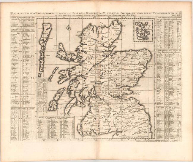
Subject: Scotland

Period: 1720 (circa)

Publication: Atlas Historique

Color: Black & White

Size:
18.3 x 13.3 inches
46.5 x 33.8 cm
Download High Resolution Image
(or just click on image to launch the Zoom viewer)

Beautifully engraved map with good detail throughout and pictorial representations of topography and towns. The map is roughly 13" x 13" with the title above and tables on either side. These interesting tables list more than 300 towns, villages, baronies, duchies, viscounts, counts, and marquis that are keyed to the map. The Orkney Islands are inset at the upper right.

References:

Condition: B+

A sharp impression on a sheet with a Strasbourg bend and lily watermark. There is light toning along the centerfold and faint offsetting.

Estimate: $200 - $230

Sold for: $150

Closed on 9/11/2024

Archived