Subject: France & Belgium
Period: 1729 (published)
Publication: Introductionis in Universam Geographiam
Color: Hand Color
Size:
12.9 x 10.6 inches
32.8 x 26.9 cm
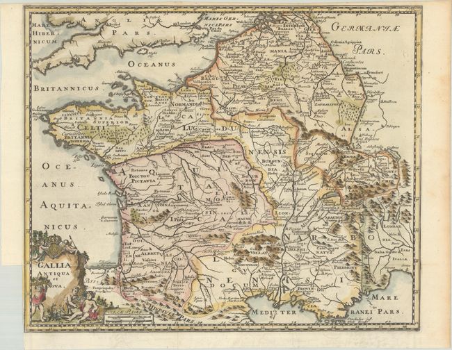
A charming map of France and Belgium presenting "modern" topography with ancient place names. It is adorned with a fanciful title cartouche topped with the crest of France.
Cluver's Introductio in Universam Geographicam was a popular atlas, appearing in over 45 editions during a 100-year period. The first edition was published without maps in the 1620s, and the first edition to include maps was published circa 1641. The various editions were published in different cities throughout Europe, including Amsterdam, Nuremberg, and London. This map is from an Amsterdam edition, edited by Bruzen de la Martiniere with maps by Jan Wolters and four newly engraved maps after Delisle.
References: Shirley (BL Atlases) T.CLUV-8b #4.
Condition: A
A crisp impression on a bright sheet of watermarked paper. Issued folding with a small binding trim at lower left.