Subject: Cartographic Miscellany, World
Period: 1683 (published)
Publication: Description de l'Univers
Color:
Size:
4 x 5.8 inches
10.2 x 14.7 cm
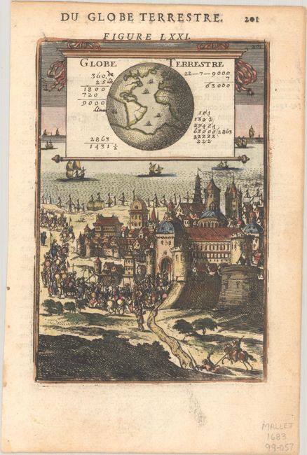
A. [Figure LXXI] Globe Terrestre, hand color. Interesting miniature engraving featuring a globe rendered onto a cartouche fashioned as a wall map with mathematical calculations surrounding the globe. This hangs above a fortified medieval city from which a military procession marches toward the sea. The map depicts the hemisphere centered on the Atlantic Ocean showing most of America, Europe and Africa and the enormous continent at the South Pole as well as numerous sailing ships. French text on verso. Condition: A dark impression with light soil in margin, else fine.
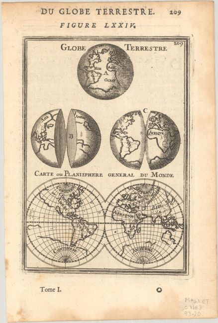
B. [Figure LXXIV] Globe Terrestre [on sheet with] Carte ou Planisphere General du Monde, black & white. An interesting sheet with four different depictions of the world. At top is a sphere focusing on the Atlantic Ocean. At center are two globes, each partially split in two. At bottom is a double hemisphere map showing the island of California. French text on verso. Condition: A nice impression with light dampstains along the edges of the sheet.
References: Pastoureau, MANESSON-MALLET I A [71] & [74].
Condition: A
See description above.