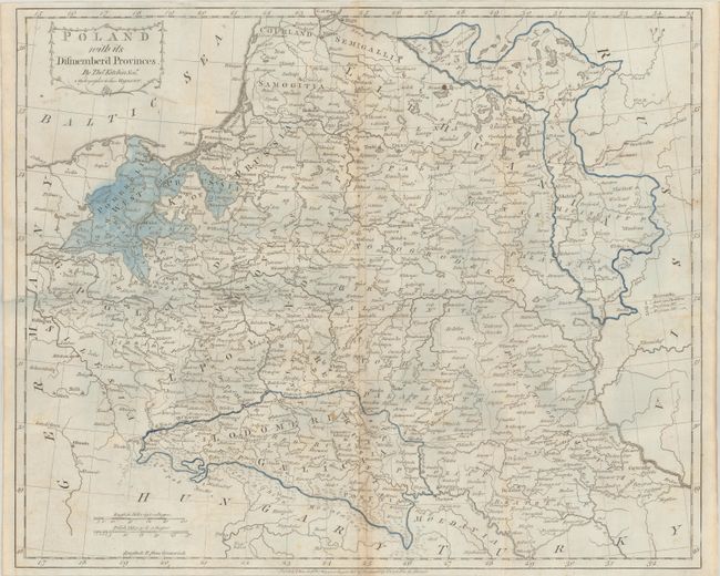
Subject: Poland
Period: 1784 (dated)
Publication:
Color: Hand Color
Size:
19.8 x 16.2 inches
50.3 x 41.1 cm
This map of the Polish-Lithuanian Commonwealth was published 12 years after the First Partition of Poland. Three areas were seized by neighboring powers including Prussia (northwest), Russia (east) and Austria (south). After the reign of Augustus III (1696-1763) weakened the Commonwealth, the Russian Empire, the Kingdom of Prussia and Habsburg Austria decided upon partitions of the Commonwealth, and simultaneously sent troops to occupy the newly annexed territories. The Commonwealth was unable to protect the occupied provinces, and ultimately lost 30% of its overall territory in the partition. Decorated by a garland-style title cartouche. Published by T. Cadell in London.
References:
Condition: B
Issued on fleur-de-lis watermarked paper that has been backed with tissue to repair a number of worm tracks in the upper third of the image. There is faint offsetting and light toning along the centerfold.


