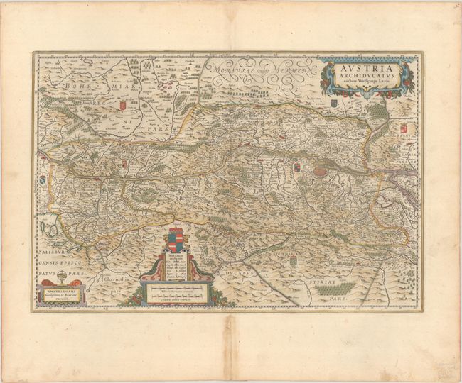
Subject: Eastern Austria
Period: 1659 (published)
Publication:
Color: Hand Color
Size:
21.6 x 14.4 inches
54.9 x 36.6 cm
This striking, large map of the Danube River valley is based on the cartography of Wolfgang Lazio. Vienna is prominently featured with the Danube river flowing across the center of the map. The map extends south to Graz and west past Linz, but not as far as Salzburg. Numerous tiny villages, cities, mountains, forests and lakes are depicted. Three decorative cartouches grace the map, including a coat of arms. This was among the plates that were sold to Blaeu after Jodocus' death in 1629. Hondius' imprint has been removed and replaced with Blaeu's own imprint. Spanish text on verso, published between 1659-72.
References: Van der Krogt (Vol. II) #2710:2.2.
Condition: A
A dark impression with full contemporary color on a bright sheet with a large watermark of the god Atlas and wide margins. There are a few tiny worm holes in map, only visible when held up to the light. There is a centerfold separation in the bottom margin that has been closed on verso with non-archival materials, causing some toning in the area, not affecting map.


