Subject: Black Sea
Period: 1775 (circa)
Publication:
Color: Hand Color
Size:
38 x 19.4 inches
96.5 x 49.3 cm
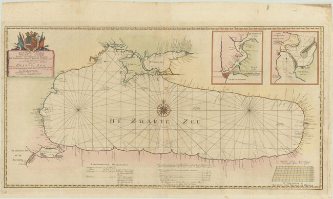
This rare two-sheet map of the Black Sea was published by Johannes van Keulen en Zoonen, a partnership of the two sons of Johannes van Keulen II. The map is based on the observations of Captain Jan Hendrik van Kinsbergen, a Dutch officer serving in the Russian Navy during the Russo-Turkish War. Kinsbergen obtained leave from the Dutch navy in order to serve for Russia from 1770-75. During that time he served as a Captain on several campaigns in and around the Black Sea. This map served as a great improvement in the mapping of the Black Sea, noting numerous towns and rivers along the coast as well as depth soundings and safe anchorages in the waters. The sites of major sea battles between 1772-74 are identified by crossed sabers. Two large insets are included depicting the Bosporus Strait and Istanbul, as well as the Kerch Strait. The title cartouche dedicates the map to William V, Prince of Orange, by Joan van Woensel. On two sheets, joined.
References:
Condition: A
A dark impression, issued folding, now flattened with archival repairs to tiny separations at the fold intersections, light printer's ink residue, and a couple of minor spots. There is some marginal soiling.