Subject: Middle East
Period: 1742 (circa)
Publication: Geographia Antiqua et Nova
Color: Hand Color
Size:
11.6 x 7.8 inches
29.5 x 19.8 cm
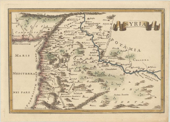
This map by Nicolas Lenglet Dufresnoy shows ancient Syria between the prominent Euphrates River and the Mediterranean. The map identifies several towns and cities, including the Hellenistic city of Antiochia on the Orontes River. It is embellished with a banner-style cartouche. Dufresnoy published several editions of his ancient geography in London between 1742-99, as well as two Dublin editions in 1761 and 1786 with a new set of maps that were close copies of the London edition. The maps are all in the tradition established by Cellarius's ancient geography.
References: McCorkle (18th C. Geography Books) #211- Tab. XXIII.
Condition: A
A nice impression on a faintly toned sheet with marginal soiling and a couple of minor creases in the corners.