Subject: Holy Land
Period: 1750 (dated)
Publication: Atlas Universel
Color: Hand Color
Size:
23.2 x 18.9 inches
58.9 x 48 cm
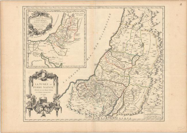
Lovely, large map of the Holy Land divided among the Tribes on both sides of the River Jordan. It covers the region with the shoreline from Sidon to Gaza and inland to Syria and the Arabian Desert. A large inset map shows the Nile Delta, Sinai and Canaan with the Wandering of the Children of Israel, titled "Carte de la Terre de Canaan ou Terre Promise…" The map is filled with fine detail and ornamented with two elaborate cartouches. This is the first state.
References: Laor #667; Pedley #393.
Condition: B+
Nice, dark impression and contemporary outline color on a sturdy sheet with a large watermark of a Maltese cross encircled in rosary beads. There is very light toning along the centerfold and edges of the sheet, a printer's crease at bottom center, and some wormtracks in the margins, not affecting map.