Subject: Asia
Period: 1667 (published)
Publication: China Illustrata
Color: Hand Color
Size:
20.7 x 16.4 inches
52.6 x 41.7 cm
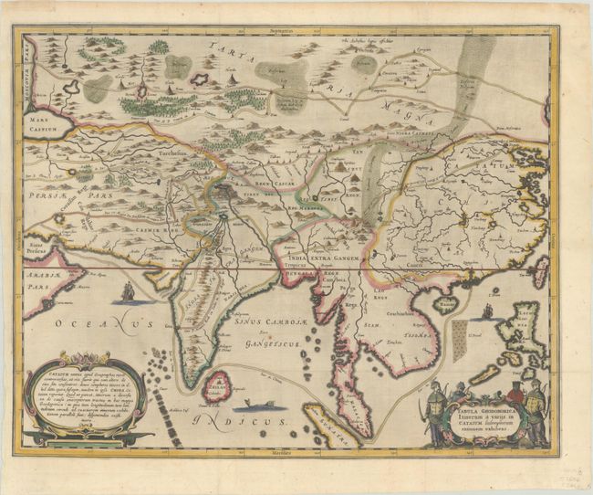
This fascinating and uncommon map of Asia depicts the land and sea routes from the Middle East to China and northern Asia. Roads, towns, rivers, lakes, and mountains are all depicted graphically. The outlines of the Philippines and Southeast Asia are still quite rudimentary. Couchinchina is labeled in northern Vietnam, and Pegu Regn (now Bago, Burma) is shown south of Camboia (Cambodia). Lao Regn. is also located. Embellished with two strapwork cartouches and Chinese merchants. This map appeared in Kircher's China Monumentis, also known as China Illustrata, which was published in Latin, Dutch and French editions.
References:
Condition: B+
A dark impression, issued folding on a bright sheet. There are professional and nearly invisible repairs to tears along the edges of the sheet, with only two entering the image: into the border at top right and from the left side of the sheet extending to India.