Subject: Northern Asia
Period: 1749 (circa)
Publication:
Color: Hand Color
Size:
9.9 x 6.5 inches
25.1 x 16.5 cm
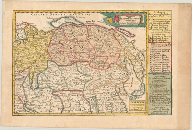
This densely engraved small map spans from Russia, the Caucasus, and Persia in the west to Japan and a wildly misshapen Terre Iedso (Hokkaido) in the east. It is filled with pictorial representations of forests, mountains, tent encampments, and an illustration of the Great Wall of China. A pair of ships sail in the Sea of Japan. The mythical Chiamai Lake is shown in a smaller configuration, with another mythical lake to its southeast with four rivers flowing from it. An Insula inhabitata appears to the north of Kolyma. The title cartouche is flanked with figures representing European and Asian men. Panels of text at right provide more information on political divisions.
References:
Condition: B+
Contemporary color with light toning.


