Subject: Madagascar & the Comoros
Period: 1679-1765 (circa)
Publication:
Color: Hand Color
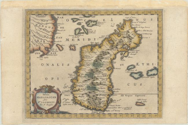
A. Insula Madagascar sive Sti. Laurenty, by Nicolas Sanson, from Die Gantze Erd-Kugel, published 1679 (9.8 x 7.8"). Finely engraved, decorative map of Madagascar and the coast of Mozambique. Great detail of the surrounding islands and navigation hazards in the Gulf of Mozambique. The map is ornamented with an attractive title cartouche. Published in Johann David Zunners' rare German translation of Sanson's L'Afrique en Plusieurs Cartes. Reference: Pastoureau, SANSON I E. Condition: A dark impression with light printer's ink residue on a faintly toned sheet. The top margin has been extended to accommodate framing.
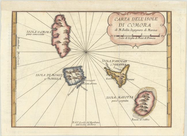
B. Carta dell' Isole di Comora, by Jacques Nicolas Bellin, from Lo Stato Presente di Tutti i Paesi e Popoli del Mondo Naturale, circa 1766 (9.1 x 6.7"). This uncommon map covers the Comoros islands, located in the Madagascar Channel, between Africa and Madagascar. The chart details the islands of Grand Comore, Moheli, Anjouan, and Mayotte, with notes on anchorages and the small amount of knowledge of the islands at the time. It was published in Volume XXVI of Lo Stato Presente di Tutti i Paesi e Popoli del Mondo Naturale, Giambatista Albrizzi's Italian edition of Thomas Salmon's Present State of All Nations. Condition: A crisp impression issued folding, now flat, with minor offsetting. Remargined at top to accommodate framing.
References:
Condition: A
See description above.