Catalog Archive
Auction 199, Lot 678

"Carte Generale de la Coste de Guinee Depuis la Riviere de Sierra Leona Jusqu'au Cap de Lopes Gonsalvo pour Servir aux Vaisseaux du Roy...", Bellin, Jacques Nicolas

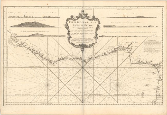
Subject: Western Africa

Period: 1750 (dated)

Publication: L'Hydrographie Francoise

Color: Black & White

Size:
34.9 x 21.6 inches
88.6 x 54.9 cm
Download High Resolution Image
(or just click on image to launch the Zoom viewer)

Striking sea chart of the western coast of Africa from Sierra Leone to Cape Lopez. Six coastal views and a huge decorative title cartouche fill the interior. The chart is engraved with minute detail including anchorages, navigational hazards, soundings, forts, settlements, and watering places. Bellin, attached to the Depot de la Marine, became hydrographer to the King and a member of the Royal Society of London. He was commissioned to map all the known coasts of the world, resulting in the maps of this superb atlas.

References: Phillips (Atlases) #587.

Condition: B+

A dark impression on a sturdy sheet with an eagle watermark. There is very light soiling, minor offsetting, and some pencil notations from a previous owner. There is a gray shadow along the centerfold that is caused by our scanner and doesn't appear on the map itself.

Estimate: $160 - $190

Sold for: $90

Closed on 9/11/2024

Archived