Subject: New Zealand
Period: 1845 (circa)
Publication: National Atlas
Color: Hand Color
Size:
19.8 x 24.1 inches
50.3 x 61.2 cm
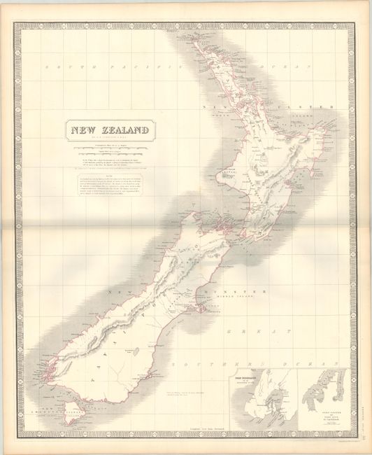
A large map of New Zealand showing the early, transitional provinces of New Ulster, New Munster and New Leinster. These divisions were created in 1841 and abolished in 1853. The islands are also carrying their Maori names of Tavai Poenamo for the Middle Island, and Eaheino Mauwe for the North Island. The inset at lower right has small maps of Port Nicholson and Port Cooper.
References: Tooley (Australia) #764.
Condition: A
Contemporary outline color on a sturdy sheet with a couple of faint spots. The grayish hue along the centerfold is caused by our scanner and is not present on the physical map.