Subject: North America
Period: 1779 (circa)
Publication: A New Geographical, Historical, and Commercial Grammar...
Color: Hand Color
Size:
8.8 x 7.6 inches
22.4 x 19.3 cm
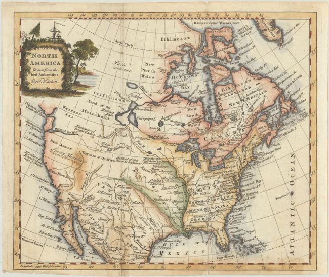
The title cartouche conveniently hides the unexplored northwestern regions on this map of North America. But below the cartouche there is still a wide variety of speculative cartography. The Western Sea has only the western coastline delineated and the entrances are noted as discovered by Juan de Fuca and Aquilar. The River of the West also apparently ties into this vague sea and is connected by a dotted line to Pikes Lake and Manlons R. There is an east-west range of mountains below New Albion labeled the Snowy Mountains. A river in the approximate location of the Colorado is called Martyr's R. The intermountain region is labeled Teguayo & Quivira and central Canada has a bizarre system of lakes and rivers. Locates many Indian tribes, Buffalo Meadows, forts, etc. The British colonies are shown with their western boundaries on the Mississippi River. According to McGuirk, this is the first state of the map, with the decorative title cartouche, likely from the 1779 or 1782 edition of Guthrie's geography.
References: McCorkle (18th C. Geography Books) #162-17; McGuirk #172.
Condition: B
A nice impression with a small area of soiling near the "Snowy Mountains." There are a few edge tears at bottom that have been closed on verso with old paper, with some light associated adhesive stains showing through on recto. Issued folding.